Start with one useful satellite tracking experience
An iOS satellite tracking app should begin with a concrete user goal. Someone may want to explore orbital paths, find predicted passes for a saved observing site or understand what a satellite data feed contains. Choose one primary experience and make its first result easy to reach. A globe, an account system and background location are separate product decisions, not automatic requirements.
For a pass-planning concept, start with a location selector, a satellite selector and a clear list of predicted events. Offer manual location entry so people can explore without sharing their device position. Describe whether each result is a prediction, a sample or a current measurement, and show the time zone near the schedule.
Use the iOS satellite API guide as related planning material for bringing satellite information into an iPhone experience. The decisions below connect data handling with the everyday tasks an observer wants to complete.
Separate the catalog, calculations and interface
Organize the app around a few explicit responsibilities. A catalog layer identifies objects and their sources. A data adapter validates incoming records. A calculation layer produces the positions or pass information needed by the feature. The interface presents those results alongside their status. Keeping these parts distinct makes it easier to replace a provider or revise a visualization without rewriting the entire app.
Define a stable internal record with an object identifier, source, source epoch, retrieval time and documented units. Represent unavailable and stale data explicitly. A blank array should not ambiguously mean that no pass exists, the network failed or a parser rejected the response.
For each screen, specify which inputs trigger recalculation. Changing the observer may require a new pass list; changing the camera should not. Keep a small reference dataset for development so designers can review complete, empty and error states without depending on a live service during every iteration.
Ask for location when the person chooses a location feature
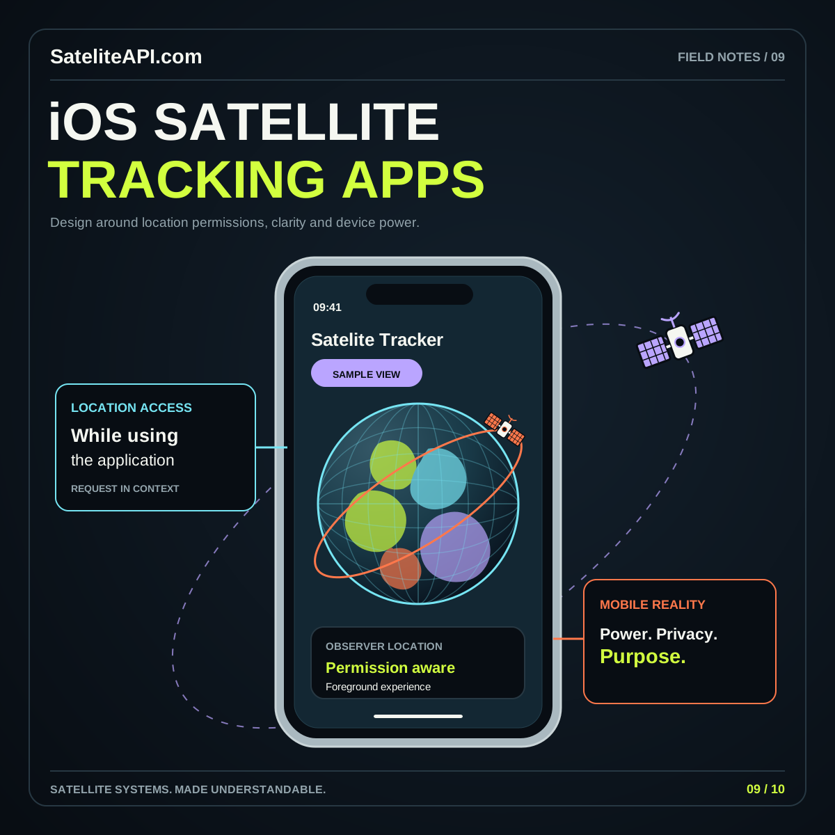
Request device location in the context of an action such as finding passes near the current position. Apple distinguishes When In Use and Always authorization in its location authorization guidance. Choose the access level that the actual feature requires and explain its purpose in language the person can understand.
A fixed observing site often offers a simpler workflow. Let the person select a city or coordinates, name the site and reuse it later. They might plan an evening from home for a location they will visit tomorrow, so the phone's current position is not always the right input.
Handle refusal as an ordinary state. Keep manual entry available and explain which feature needs location if the person returns to it. Show the selected site's name above the predictions so nobody confuses a remembered location with the device's present position. A location control should support the planning task rather than interrupt it.
Imagine someone planning a weekend visit to a hill outside their city. They save that hill while sitting at home, then open the app again after arriving. Ask whether they want to keep the saved observing site or use their current position. An explicit choice protects the planning context and makes the resulting schedule easier to explain if it changes after the switch.
Match location activity to the observing workflow
Apple's location energy guidance recommends reducing unnecessary accuracy and stopping location updates when they are no longer needed. Apply that principle to the feature rather than treating continuous positioning as a default. A person reviewing tonight's passes from a fixed site does not need the same location behavior as someone actively moving between observing points.
Define when a location session starts and ends. For example, a current-location button can obtain a useful position, populate the observer field and let the person continue with a saved site. If your design genuinely needs ongoing movement, explain that mode and provide a visible way to finish it.
Keep the satellite animation separate from location collection. Smoothly updating a visual should not automatically demand a fresh phone position for every frame. Review power use during a realistic session with the screen on, then after the user leaves the relevant view.
Build reminders around explicit, revisable predictions
Offer a reminder only after a person selects an event they care about. Apple advises checking notification authorization because people can change it at any time; see its notification permission guidance. Keep the saved event visible in the app even when alerts are unavailable.
For a known predicted time, a local notification can be scheduled with content and a time-based trigger. Apple's local notification guide also explains how request identifiers allow pending notifications to be found and canceled. Use that capability when an observer changes or refreshed data changes the event.
Write the reminder as a prompt to review the prediction, not a guarantee of visibility. Include the satellite name and selected observing site. In the app, show the prediction's data status and a way to cancel the reminder. Decide how your product handles time-zone changes and expired events before adding a large notification settings screen.
Make saved places, network use and offline states understandable
Write a simple data-flow description for the app team: which information stays on the device, which information goes to a provider and which information is retained by your own service. Use that description to challenge unnecessary collection. A preference for one satellite does not automatically require an account or a history of precise observing locations.
Give saved places clear names and a delete action. If a server needs coordinates to calculate results, disclose that in the feature explanation. Avoid storing full request details in routine logs when a less specific diagnostic record would answer the same support question.
For offline use, distinguish reading cached content from producing a newly refreshed prediction. Show when the dataset was obtained and how the app judges its usable interval. Let the person inspect previously saved information, but make its status visible. A thoughtful offline screen answers what remains available and what needs a connection.
Review the app with changing permissions and imperfect data
Test the complete journey with location allowed, refused and changed in Settings. Repeat it with notifications disabled, no connection and an old dataset. Check that a saved site remains identifiable and that an outdated reminder does not survive a deliberate change of observer. These scenarios reveal more about reliability than a successful first launch alone.
Review larger text, screen-reader navigation and one-handed operation. Keep the main event details available outside a rotating globe, and ensure the selected date and time zone stay visible. If the interface uses an illustrated sky view, explain its orientation and provide an ordinary list of the same events.
Compare a few prediction results with a trusted reference before presenting them as useful planning information. Continue with the satellite tracker API guide for data considerations, or the Android satellite app article to compare platform design choices.
Sources and further reading
- Apple: Choosing the Location Services Authorization to Request
- Apple: Reduce Location Accuracy and Duration
- Apple: Asking Permission to Use Notifications
- Apple: Scheduling and Handling Local Notifications
Sources were consulted for this general guide. Illustrations are explanatory; orbital and screen examples are not live telemetry.